
Before something is an art, it is a science
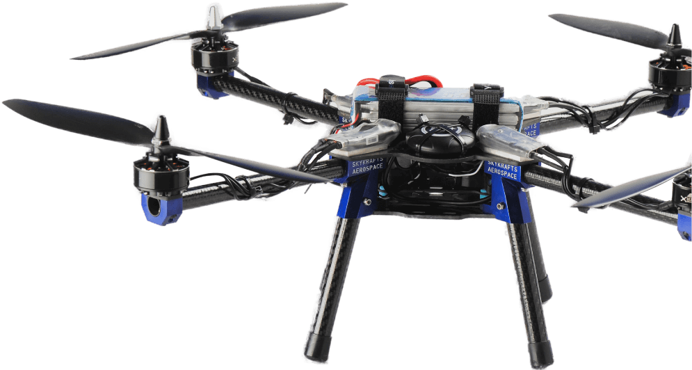
RAV, the plug-n-play enterprise drone platform of choice to develop dependable UAV applications. Deploy your software or hardware applications on the companion computer and integrate your payload into the smart payload bay.
RAV allows enterprises to standardize drone operations across jobsites and share data with others. With its ability to integrate user’s payload and deploy application stack including AI bundle, RAV is the dependable platform your enterprise is looking for in a drone.
Why reinvent the wheel when you can leverage our technology platform, that minimizes your time to market, risks and helps you confirm with policy detailing. We’ve understood industrial use cases and built this enterprise drone platform to address them.

Agriculture
An RAV drone can be fitted with multi-spectral sensors to analyses crop health and soil conditions precisely. NDVI data in combination with other indexes can provide valuable insights into crop health and provide actionable information.

Inspection
RAV’s ability to capture precise imagery data both in daylight and in night time with photographs providing centimeter accuracy. RAV can play a pivotal role in locating problems in the systems that are vital to our daily lives.

Insurance
An RAV drone can capture images of property to be insured quicker than a human inspector, the same property can be revisited in case of a disaster to estimate the extent of damage. This reduces the turnaround time on claims.

Infrastructure
The intricacies of planning, designing & supervision of large scale infrastructures such as smart cities, bridges, railways networks, dams or roads can be simplified with a friendly eye in the sky of an RAV. This is the foundations for evaluating vital infrastructure after disasters.

Emergencies
Aerial patrol by RAVs can detect hot-spots in an emergent situation and assist in scaling a disaster, it reduces the time to respond. RAV drones can prove vital in rapidly mapping the affected area and can be critical in optimizing rescue resources and unclog bottlenecks.

Surveying
RAVs can provide GIS professionals with tools to help identify property boundaries, subdividing land, surveying construction sites, estimating mineral deposits, with the right tool they can also help produce topographic and hydrographic maps.

Forestry
Within a short duration an RAV drone can take hundreds of pictures that can be stitched together into a high resolution orthographic maps. These orthomaps can be integrated with GIS and used to improve forest management, planning and monitor illegal activities.

Research
An RAV mounted hyper-spectral sensor can gather high resolution data, this can be used for monitoring a range of environments, for example to monitor mine sites and contaminated lands. This is an invaluable for environmental evaluation and change analysis.
Enterprise drone applications require close collabration of drone pilots, program and fleet managers. Mobile apps, ground control stations, mapping and mapping tools as well as data processing tools to create 2D-3D maps and provide insights from flight data.
RAV, the plug-n-play drone platform, is also forged with important lessons we gained along the way to help you realise your enterprise drone mission.

Compatibility

Battery Charger

Radio RX/TX

Telemetry TX/RX

RTK-GPS

LiDAR

Companion Computer

RGB Camera

Multispectral Camera

Thermal Camera

Camera Gimbal

Spare Battery

64GB Storage
TECHNICAL SPECIFICATIONS
Mechanical
Airframe Material
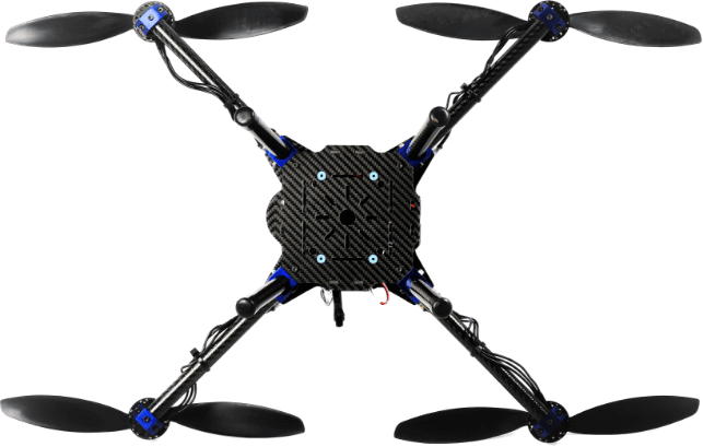
Carbon fiber and Aerospace Aluminum
Aircraft Configuration
Quadcopter X
Propeller
12″ Nylon or Carbon infused Nylon
Motor to Motor
(Diagonally) 555 mm
Height
220 mm
Weight
1650 gms
Payload Bay Area
100 mm x 100 mm x 100 mm
Electronics
Controller
ARM Cortex M4
Sensors
Accelerometer, Gyroscope, Magnetometer, Barometer.
Interfaces
PWM, I2C, UART, GPIO, CAN, USB, SD Card
Positioning
GPS and Compass Safety Switch, LED, Buzzer
Power port
5V at 3A and 12V at 3A
Miscellaneous
Battery
Lithium
Motors
Brushless DC
Propellers
12″ Carbon Reinforced/Nylon/ABS
Landing Gear
Fixed
Optional
Battery Charger, Radio RX/TX, Telemetry TX/RX, RTK-GPS
LIDAR, Companion Computer, RGB Camera, Multispectral Camera, Thermal Camera, Spare Battery

